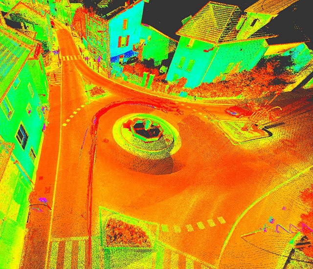
After assembly and georeferencing, the 3D data collected can be used to produce results adapted to all types of requirements:
- Topographic maps:
- Road and highway systems,
- Industrial infrastructures,
- Rail lines,
- Simplified street maps,
- GIS (Geographic Information System)…
- 3D modeling:
- 3D city models,
- Urban furniture,
- BIM…
- Sizing assessments:
- Tunnel, galleries,
- Road and highway structures, overpasses, underpasses…
- Safety assessments:
- Pavement geometry,
- Slide rail height,
- Signage…
- Surveys of industrial infrastructure on production sites:
- Factory,
- Storage areas,
- Quarries…
- 360° photographic panoramas
Technical equipment
In 2014 the company acquired a Leica Pegasus Two System integrating:
- An ultra-high frequency laser profiler Z&F 9012, with 8 cameras,
- A GNSS navigation system,
- An inertial unit (IMU),
- An odome
The compact Pegasus system can be mounted on any type of vehicle and can perform all types of topographic surveys with a very high level of accuracy and efficiency.
In the road and highway field, surveys can be performed without interrupting or disturbing traffic as the vehicle drives at the same speed as other users.
The data captured by current mobile mapping systems are processed using dedicated software:
- MapFactory for ArcGis
- TerraSolid suite
They can also be displayed using big data type solutions, allowing interactive sharing via web streaming between different people involved in the same project.
Photo/scanner coupling is used to color point clouds, easily identify equipment (manholes, road markings, various equipment…) and distinguish between the different materials within the point clouds.
The different 2D and 3D products resulting from post-processing can be exported into the format needed by the client (vector maps, cross-sections, 3D models, DTM, DSM, tables of data and deformations, etc.)

