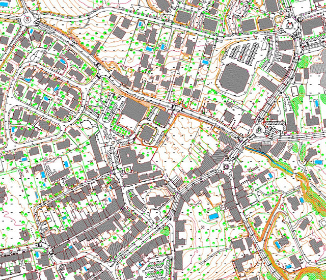
Aerial photogrammetry produces topographic maps and/or orthophotomaps at all scales, from 1/25 000 to 1/100 and is especially adapted to large areas or hard to reach zones.
The digital mapping produced has many applications including:
- A comprehensive overview of a territory:
- GIS (Geographic Information System),
- DEM (Digital Elevation Model),
- DTM (Digital Terrain Model),
- DCM (Digital Canopy Model)…
- Hydrography and dams:
- Topographic maps,
- Preliminary impact studies,
- Measuring hydraulic drop height,
- Dam tank calculations,
- Rising water level simulations,
- Watershed calculation, runoff…
- Infrastructure studies:
- Surface and volume calculations,
- Land use planning (civil engineering, Building and Public Works, architecture, urban planning),
- Simplified street map,
- Communication lines (roads, highways, rail, canals…),
- Data and energy transport (power lines, fiber optic cabling),
- Renewable energies (wind turbines, solar panels),
- Mountain development,
- Pipelines…
- Natural hazards:
- Gravitational hazards (rockfall trajectories, trajectography),
- Flood risk mapping,
- Deformation monitoring (land slides, material transport, cliff erosion),
- Glacier monitoring, avalanche risk mapping,
- Emergency surveying following a major event…
- Quarries and mines:
- Site monitoring,
- Volume calculations,
- Site assessment,
- Site rehabilitation.
- Environmental studies:
- Assessing the environmental impact of a project,
- Consulting, expertise, land use project simulations…
- Forestry and agriculture:
- Potential irrigation area,
- Detection of plant types,
- Forestry inventory…
- Archeology and heritage:
- Assessments,
- Project monitoring,
- 3D modeling…
- Texturation and coloring tool (« mapping »): combining a photograph with a DEM (Digital Elevation Model) for a more realistic picture of the scene.
- Status archiving:
- To preserve a legal record effective against a former status,
- Assessment after a natural catastrophe…
These applications all have their constraints which our engineers carefully analyze to deliver innovative solutions tailored to the requirements of each particular case.
Technical resources and equipment
Our company deploys different types of aerial survey aircrafts and sensors:
- Single engine (Cessna 206TU) or twin engine (Beechcraft 200, Beechcraft 90, Partenavia P68C) aircrafts
- Helicopters
- Rotary wing UAVs (Terradrone, DJI) or fixed wing UAVs (eBee)
- Large format cameras (Z/I DMC and DMCII)
- Medium format cameras (Leica RCD30, Hasselblad and Phase One)
The pictures can be acquired in natural color (RGB) or in near infrared (NIR). Thanks to our equipment, we are flexible and can deliver optimal customer solutions with fast turnaround times. Our in-house equipment (hardware and software) gives us great autonomy in the field in case of unforeseen events.

